
Because It's There. (Sort of.)
By McKenzie Funk
First published in Outside Magazine, June 2008
Of all the arguments Greg Michaels employs to make his life's work seem less inane, the best may be the one about the millennium. "I would sort of debate with my NASA friends," he says. "I'd talk to them about confluence hunting and they'd be like, Oh, yeah, whatever,' and then later on I'd find out they thought it was a really stupid idea. I talk to my friend George and he's like, The confluence point has no meaning, it's just totally arbitrary, it doesn't relate to anything, why would you want to go after something like that?' But then I'm like, how about the millennium, you know?
"George made a really big deal about the new millennium," Greg continues. "I think he went to Easter Island to celebrate it. But it's an arbitrary time. In a lot of ways it's the same: Everyone can agree on the millennium as a marker of time. But a confluence is something everyone can agree on as a marker of place."
Greg tells me this as we stand, lost, in a village in western Bolivia, surrounded by alpaca droppings and bicycle tracks and adobe huts with straw roofs and cactus-wood doors. Our location is 18°50.983'S, 68°31.233'W certainly nothing special, not for a man of Greg's stature and we're just miles from the border with Chile, which is marked by a reddish, perfectly conical volcano. Ahead, across the Altiplano plateau, are the glaciated peaks of Sajama National Park, home to the highest confluence point in the Western Hemisphere. We think we can see the mountain we'll have to climb to reach it, but we can't be sure, and in any case it's 65 miles away. First we have a bog to negotiate.
Our driver, Criso Ibieta, and cook/navigator, Maria Garcia Medina, clearly have never been here. Since yesterday afternoon, they've been bickering about directions and relying heavily on photographer Paolo Marchesi's Bolivia map and on my new GPS, which now sits between them in an honored spot on the front seat of the Land Cruiser. Soon there are two dirt tracks to choose from; we go with the one that heads straight toward Sajama, bouncing along for a mile until it dead-ends at a river in a broad, soggy meadow. Beyond the river are sand dunes, more volcanoes, and hundreds of alpacas. We get out and walk up the banks, trying and failing to find a place to cross. We stare at the volcanoes. Greg stops to snap a photo. He's sporting sunglasses, a soul patch, and a pair of those zip-off travel pants that convert into shorts looking, as always, about a decade and a half fitter and younger than his 39 years.
"We'd probably be on some tourist path if we didn't have this mission," he says. "You might think I get a little carried away, and some people say that I am, but most of the world has been explored. This is a measured way to assure that we visit all the in-between spaces that we see what's there. Confluence hunting is the last frontier."
WHAT GREG MICHAELS DOES, to be precise, is make expeditions, GPS in hand, to the places on the earth's surface where integer latitude and longitude lines intersect, like 44°N 144°E, on the Japanese island of Hokkaido, one of his many Asian prizes. He was the first to bag a confluence in Taiwan, the first to bag one in Vietnam, and the first to bag what he calls "the center of the northeastern quadrasphere" 45°N 90°E, in western China. It was Greg who tried (and failed) to sweet-talk his way into North Korea to claim that country's first confluence, posing as a journalist and trying to hitch rides with Russian and Chinese boat captains. It was Greg who decided to go after the world's ten highest confluence points and reached what may be the very highest, at 19,113 feet on a nameless Tibetan peak, in May 2005. That expedition involved a week of hitchhiking, a 70-hour bus ride, severe altitude sickness, and cat-and-mouse games with the Chinese military.
Greg's description of the Tibet experience on confluence.org, the official Web site of the Degree Confluence Project (DCP), is second only to his description of a 2004 victory in Japan over skilled confluence hunter Fabrice Blocteur, a French-Canadian whom he raced mightily for the last of the confluences on Japan's main island, Honshu. The point's thick-jungle approach had previously beaten back Blocteur. Greg won after finding a waterlogged dinghy, paddling it down a river to bypass the worst of the jungle, and scaling a cliff, Princess Bride style, to reach the spot. A few months ago, Greg was featured on the home page of the DCP Web site for bagging the last points in Europe: four in Bosnia that others had avoided because of land mines. He carried maps from the Bosnia-Herzegovina de-mining commission and somehow survived with all his appendages.
According to the DCP which was founded in 1996 by Alex Jarrett, a bored New Hampshirite looking for something to do with his new GPS there are some 16,232 "primary" (i.e., not in the middle of an ocean) confluences on the planet: 14,029 on land, 2,203 in water but within sight of the shoreline, and 151 on what's left of the polar ice caps. So far, about a third of these, 5,324 points, have been visited and documented, and 10,405 confluence hunters in 177 countries on seven continents have snapped 71,929 pictures to prove they were there. Thanks to Greg, every confluence in mainland Europe has now been reached. Thanks to his compatriots, every confluence in every American state but Alaska has been reached. The DCP's map of the lower 48 has become a sea of red dots.
There are easy confluences and there are hard confluences, and if you're standing on this planet, you're never more than 49 miles from one. Some people simply get in their car and visit those nearby; some visit the same points again and again. But Greg does neither. Until last summer, when he made an attempt at the highest confluence in North America, 26°N 144°W, at 13,418 feet in Alaska's Wrangell St. Elias National Park, he'd never even bothered to try one in the States. His 27 successful visits are thus a paltry few compared with those of 100- and 200-confluence legends Captain Peter, Gordon Spence, Targ Parsons, and Joseph Kerski, but a confluence hunter cannot be measured by stats alone.
"Captain Peter kind of cheats," Greg says of the Sicilian freighter captain Peter Mosselberger, who has racked up 230 confluences in 52 countries. "Well, not cheats, but he has a cargo ship, right, so he just goes and gets the ones offshore." Brits Spence and Parsons, meanwhile, are obsessed with reaching every point in the UK and China, respectively. Kerski, a former USGS geographer, sticks mostly to the United States. Their feats don't seem to impress Greg. While others go around gobbling up dots, he is something different: a visionary, a seeker of truly superlative nowheres, a man with an eye for only the most special arbitrary places.
ON GOOGLE EARTH, 18°S 69°W is shown perched on the southeast face of a dormant volcano called Jachcha Condoriri, protected by cliffs above and below, its crosshairs marking a bulge of igneous rock in a field of scree. Its elevation is an imposing 16,961 feet, but the surrounding terrain does not look impassably steep. To gaze at it on Google Earth is to play God, flying back and forth above a digitized, photorealistic mountainscape, spinning until you've seen it from every angle and taken in every obstacle. There could be a snowfield or two to navigate on the hike in. There's a possible couloir route between the cliffs. If bad weather rolls in, the scree slope may be the way to make a quick escape.
Zoom out and the approach becomes obvious. A quarter-mile north of the confluence, via either a couloir or an open slope that skirts the cliffs, is a false summit at 17,477 feet. Leading directly to it is a clear, treeless ridgeline with a relatively gentle angle. Zoom farther out and the world becomes ever more barren and volcano-spotted, and you see the faint outline of a jeep track that happens to bisect the bottom of the ridgeline. The track leads to a nearby village just nine miles across the Altiplano as the crow flies and if you zoom back in you can see its name: Tomarapi.
Tomarapi is tiny, but a Web search reveals that it is home to a new, Aymara Indian run eco-lodge: room and board for less than $40 a night. The giant volcano lording over Tomarapi and the confluence mountain turns out to be Nevado Sajama, at 21,463 feet Bolivia's highest peak, and the area surrounding it turns out to be Bolivia's oldest national park. Because national parks the world over tend to have transport for hire, logistics will be the easy part.
As for the approach routes to Tomarapi and to Bolivia itself, they were outlined in Greg's Lonely Planet guidebook. He flipped through it in Brazil, where he was posted as a geophysicist aboard a roving seismic-survey ship his day job and later that week boarded a string of buses. First from Rio to some islands off the Atlantic coast (a getaway with a local girl he'd met); then to Iguaçu Falls, at the Argentina border (where there was a mock Mardi Gras at a hostel famous for its huge swimming pool); then nonstop across the width of Argentina to the town of Salta, near the Bolivia border ("I had to go there," Greg said, "because it's Atlas spelled backwards.") In Salta, he tried to buy some soap (jabón) at a grocery store and ended up in the ham (jamón) section. Greg does not speak Spanish. That night he went out for pizza with a pack of 14-year-olds he'd met on the street and one of their moms. The next day he went on a tour of the nearby canyon country. The day after that he got himself across the border.By the time Paolo and I caught up with him, in the desert town of Tupiza, Bolivia, Greg had spent 68 hours riding public buses toward the confluence, and together we did another eight to reach the town of Uyuni, where we switched to a Land Cruiser. He rode without complaint or apparent discomfort, jamming out to his MP3 player, reading Berlitz's Spanish in 30 Days, and blithely falling asleep as we traversed knife-edge ridges above thousand-foot drops. The bus smelled vaguely of green tea from all the local coca-leaf chewers, Greg thought. We passed eight-foot cacti, a desert funeral, and a woman riding a bicycle while holding a shovel. The driver stopped every half-hour or so to pound on the chassis with a wrench, but Greg slept through it. When he woke up, he fixed his eyes on the T-shirt I was wearing, which had a large image of a king crab.
"This being a landlocked nation," he said, "that must really freak people out." Then he went back to sleep.
SO THAT'S HOW WE GOT where we are. How one gets to this point in a metaphysical sense is more complicated. "My life's story is pretty convoluted and twisted," Greg told Paolo and me over a dinner of Hawaiian pizza in Tupiza. "But it all kind of relates to exploration."
Greg wanted to go to Mars. This was his earliest dream, and he'd meant it: His majors in college were astronomy and geology. His first foreign language, which he studied during a semester in Moscow, in 1990, was Russian the era's other language of space exploration. His first real job was as an assistant on NASA's Magellan mission, in the early nineties, examining every photo the Magellan spacecraft sent back from Venus, becoming the first human to "see" large swaths of the planet. His master's was in planetary geology. And his moment of disillusionment came not when he applied to be an astronaut and was rejected only a handful of the 5,000 applicants made the cut, and he could apply again but when he realized that modern astronauts were going only as far as the International Space Station.
"My dream was to go on land somewhere," he told us. "I decided I just wanted to explore Earth more." In the grad-school library at Arizona State, he flipped through career books until he found the geophysical firm that worked in the most countries across the globe. That it turned out to be a petroleum-surveying company bothers the environmentalist in him, but Greg's story illustrates how hard a guy has to work these days to find something to explore. He's had to make some sacrifices.
For Greg, the end of the Cold War was a window of real, if fleeting, opportunity. One of his favorite stories is about when the walls were coming down, and he happened to be in Vienna, and he happened to have a raft, and he happened to notice that the Danube River flowed straight into Czechoslovakia. He climbed in and floated to Bratislava. "There was no passport control, and nobody said anything," he recalled. "I just noticed that all the buildings looked different." When he reached the city, he was surrounded by patrol boats with machine guns. When the police realized he was an American one of the few they had seen they gave him a hero's welcome, stamping his passport on the spot.
Greg's first geophysical assignment was in the Caspian Sea, which allowed him, during a drunken port call with the mostly Azerbaijani crew, to sneak visa-free into Turkmenistan a place few Westerners have seen to this day. When the Caspian job was done, in 1999, he and a friend bought a Niva an old Soviet jeep and spent months driving it around Georgia and Russia. Siberia was close to China, and China was opening up, so he drifted east, traveling overland until he'd crossed the entire continent. He went to Taiwan, where he became obsessed with learning Mandarin, which he studied until the oil money ran out. "I had to start teaching English," he says.
Globalization kept creeping on, and Greg kept teaching first in Taiwan, then in Japan. During summers he began leading tours in China for the growing horde of outsiders coming to see it. Asia was becoming less exotic, though Greg himself wasn't. One time he went alone to a Chinese zoo and noticed that everyone was staring at him instead of the monkeys. Trying to lighten up an awkward moment, he hunched over, scratching himself and making ape noises, while the crowd, still expressionless, stared harder.
You might say the confluence project gave Greg newfound purpose. But his brand of modern, confluence-driven exploration poses problems of its own. Our trip to Bolivia, for instance, was originally meant to be a trip to Peru. After I first contacted him, I invited myself along on his next expedition, and we planned it for months a trek to 12°S 76°W, in the Andes, supposedly the highest confluence in the Western Hemisphere. Then I got a late-night e-mail from him slugged "interesting development." On the DCP Web site, he told me, the Peru confluence had suddenly been demoted to number two, and an obscure point in Bolivia had been elevated to highest in the Americas. The reasons were unclear, and were only slightly less so after Greg's techy explanation:
It looks to me like the project is now using elevations from Google Earth. They originally used elevations from the GT30 1km footprint elevation data. Then, in 2005, I got a hold of the SRTM (Space Shuttle Radar Topography) data (the best data to date), and convinced them to change the data for the top 50 highest confluence points. Now it has changed again, and I've already contacted the project to find out their source. I want to make sure it is worthy.
Greg went into overdrive to find the source of the updated elevation data, spending weeks e-mailing back and forth with a shadowy Google Earth authority code-named Penguin Opus, a German- and French-speaking Scottish topography expert with an Italian name, and various DCP coordinators in Canada, Russia, and the Middle East. I received messages from him with titles like "russian plot," "a plot of points," and, eventually, "Bolivia." It was finally confirmed: We were going to 18°S 69°W, a confluence that was according to all the best data sets at least 300 feet higher than the one in Peru.
A truism of confluence hunting is that you never really know what the obstacles will be. In a string of last-minute e-mails from Brazil, Greg advised Paolo and me to be ready for anything. What looked "so inviting" on Google Earth could be treacherous in real life. We should bring crampons and ice axes. We should bring a tent and a stove. We should factor in extra time for things to go wrong.
"It could be a walk in the park," he wrote, "but, as in a lot of confluence hunting, you just need to be prepared for the unforeseen."
WE ARRANGED TO RENT a Land Cruiser in a dimly lit office in Uyuni, arriving at 6 p.m. and hoping they could have it ready by six the next morning. Time was running out for Criso and Maria, who we were told would pilot the jeep, to buy fuel and supplies, but Greg was meticulous, almost rudely so, reading a checklist out loud and asking repeatedly about water, food, spare tires, hotels along the way, what the food was, what the hotels were like, how many spares there were, how well Criso knew his vehicle, etc.
"I've had problems with Land Cruisers in Tibet," he explained. He was agitated, as if the closer he got to the confluence, the more it weighed on him, the more he wanted to control the variables. In the morning, he got up at 5 A.M., an hour early, waking himself just to organize his backpack and ensure all his gadgets were in order. He was so thorough that he was still the last one ready.
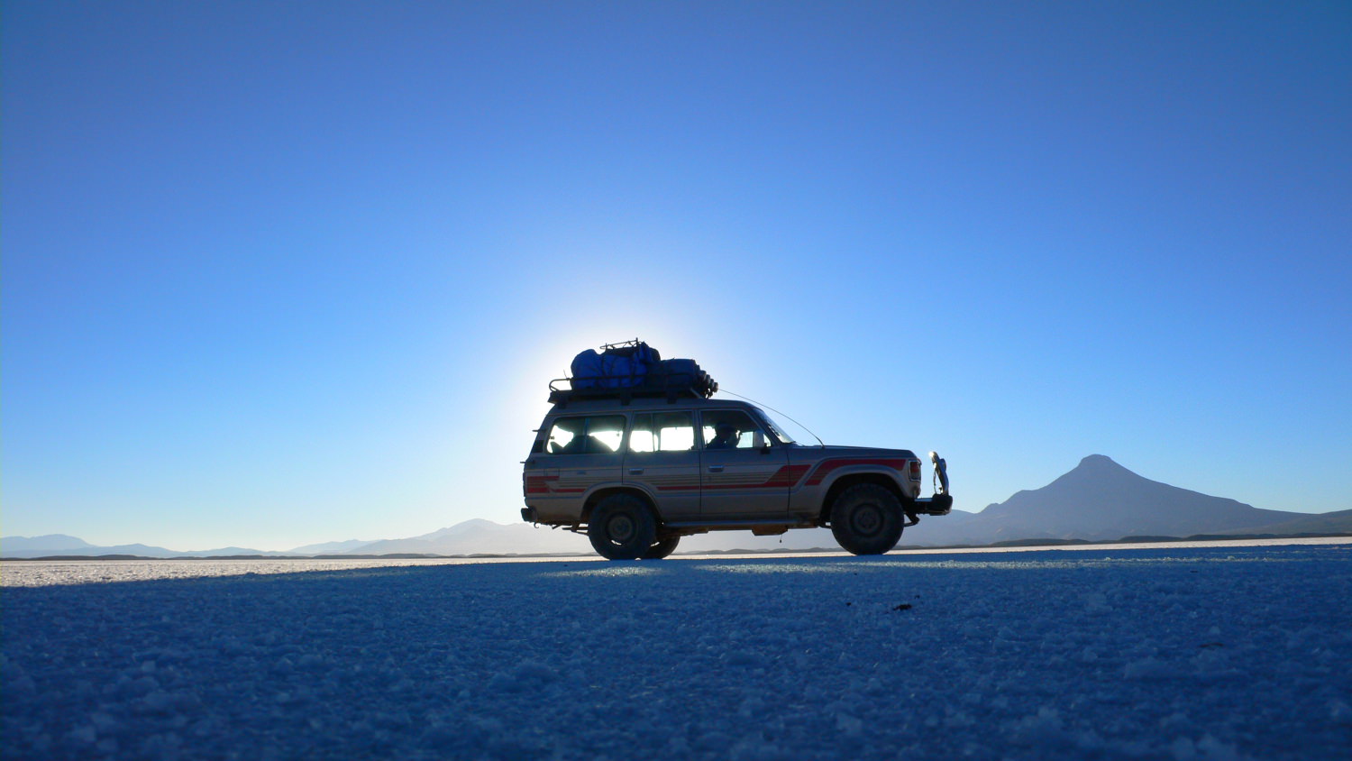
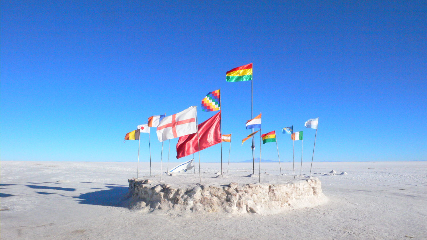
Between Uyuni and the confluence is the world's largest salt flat, some 65 miles by 65 miles. The Salar de Uyuni sits at 12,000 feet, is shaped like an amoeba, and is filled, unsurprisingly, with salt: man-made salt mounds, a salt hotel, a salt highway, saltwater springs, and blinding salt-pan views from cactus-dotted "islands." We rolled onto it at dawn, and Greg was serene again, happy about Criso and Maria's (short-lived) familiarity with our surroundings. We stopped briefly at a salt-mining operation. We ate breakfast at the salt hotel, at a table made of salt. Undisturbed, the Salar's perfectly white surface had dried to form a mosaic of interlocking hexagons that stretches miles across the emptiness, and in the distance we sometimes saw mirages or speeding trucks whose hum sounded like a jet taking off. Greg bent over to lick one of the ridges "just to make sure" it was salt. It was.
Our route took us less than a mile from 20°S 68°W, low-hanging fruit that had been bagged twice before. Perhaps for the benefit of Paolo and me, Greg decided we should go for it anyway, so after lunch he and I pulled out our GPS units and watched the numbers tick down. On Greg's wrist was an altimeter/compass watch. He had the Google Earth screen shots on his music player as well as printouts of the same, plus photocopies of some military topos. He had a backup GPS, a backup camera, and a backup compass in his bag. Combined with the arsenals Paolo and I have, this brought us to a total of three compasses, four GPS units, six cameras, and perhaps three dozen maps. We were ready for action, and I could not deny the excitement of the moment when it came.
"Tell him to slow down and go to the left," Greg told me, and I relayed his message in Spanish. Criso veered off the track, and the hum of our wheels quieted. My GPS showed the distance dropping rapidly: 1.35 kilometers, 900 meters, 250 meters, 45 meters. "Now, now, now Stop!" Greg yelled. We threw open the doors. It was windy out and very cold, and the salt crunched underfoot as I waved my GPS back and forth, trying to follow it in.
"Now I usually get out my compass and try to figure out where I need to go to make the zero," Greg said. "The GPS read .007, which meant we were a little south." We strode north, then slightly east, and my newer GPS locked it in: 20°00.000'S, 68°00.000'W, accuracy plus or minus three meters. "Photograph it as quickly as possible," Greg advised. "It'll change." He lurched back and forth, trying to get his own GPS to zero out the "confluence dance." Soon he hit it, too, and grabbed for his camera. We snapped photos in the four cardinal directions of salt, salt, salt, and salt, respectively. Greg pulled out a pad and scribbled some notes. He smiled. We were done. As we left, he took a one-boliviano coin from his pocket and placed it on the confluence agift for any brave explorers who followed.
Thus baptized, we drove out of the Salar and into the unknown, following a web of dirt roads toward Sajama, stopping for directions in almost every windswept village, relying more and more on the GPS and map. In one village, Llica, Criso asked the guys at an auto shop which direction we should go. Straight, they said. We passed a family of quinoa farmers working a barren patch of dust, Maria hopped out, and we all watched as they pointed back the way we'd come.
We found our way across a smaller salt flat, then rumbled through the Altiplano, passing deserted villages, sand dunes, and Stonehenge-like clusters of rock tombs, called chullpas, which Maria said are filled with the bones of an ancient race of midgets who were killed by the sun. We picked up and got directions from a hitchhiking grandmother and her four grandchildren, backtracked out of the bog, talked down some soldiers who wanted a bribe, got lost and found our way a half-dozen times, and overnighted in a truckers' hostel in a run-down border town. Now, on the afternoon of the second day, we've finally reached Sajama National Park, where we see a herd of alpacas grazing on the flanks of the namesake volcano.
Opposite the volcano is the confluence peak we recognize it on sight and Greg has a final request for Criso and Maria: that we use the remaining daylight to detour toward the peak and scout our line. They bristle. "Our job was to take you to Tomarapi," Criso says.
"No, no, no we need to get as close as we can," Greg says, his voice tense. "It's so ridiculous. Of all the out-of-the-way stuff we did today, we can't do this? This is the most important thing."
They go silent and make long faces, hoping he'll relent. He doesn't. Just before Tomarapi, we turn off and drive most of the way up the jeep track and stare at our destiny. It looks more or less like it did on Google Earth. Even so, we use Paolo's long lens to shoot close-up photos of the confluence, the volcanic bulge it sits upon, and the cliffs guarding the approach. That night, after a quinoa-and-soup dinner at the eco-lodge, we pull out my laptop, upload Paolo's photos, and compare them with maps and printouts until we're certain our ridge route is best. Paolo and I go to bed early, but Greg stays up late, shuffling and organizing, readying his pack, his cameras, and his multiple GPS units.
AT 5:30 A.M., WITH THE WORLD still dark, Greg sits upright in bed and flicks on his headlamp. For 15 minutes he stays wrapped in his blankets and barely moves, the beam of his headlamp conveniently pointed across the room at my face as I try to keep sleeping. Various alarms on watches, cell phones, etc. begin going off, but he doesn't move to disarm them, instead grumbling about the cold and loudly blowing his nose. He gets up and puts on deodorant, then begins walking back and forth across the room, pulling things out of bags, putting them in other bags, scattering his gear about the floor. Paolo and I get dressed. When Greg finishes his shuffling, he remembers his contact lenses and walks to the bathroom to put them in. He takes a moment to slick back his hair in the mirror. We're ready to go.
A park employee picks us up, and after 20 minutes we're at 14,700 feet, throwing on our packs in a boulder field near the foot of the ridge. The temperature hovers around freezing. A herd of wild vicuñas stands a few hundred yards uphill, and the clouds hugging the surrounding volcanoes are already burning off. Before we start walking, Greg pulls out a bag of coca leaves Maria gave him. He kneels and sticks a few down an animal hole near a big rock his way of currying favor with the native goddess of the earth: "Uh, OK, Pachamama, here you go." He also sticks a few leaves in his mouth, hoping they'll make his altitude headache go away.
We walk up the scrub slope, passing juniper-like queñua trees the highest-altitude trees in the world. The false summit is dead ahead, bathed in early sunlight; glacier-covered Sajama is directly at our backs.
"I think this is going to be easy a piece of cake," says Paolo.
"I think it's going to be harder than we think," says Greg.
"Tomorrow we should go on a jeep tour," says Paolo.
"Let's think about tomorrow tomorrow," says Greg. "Right now let's think about the confluence."
After an hour and a half, we gain the ridge, which greets us with a blast of cold wind that nearly knocks Greg and Paolo down. The confluence is before us, somewhere on an escarpment in the middle of a vast bowl of scree our first good view. Greg waves his arms and yells through the wind: "I've got to take a bearing!" When he's done, we back away from the edge until we're out of the wind. He fiddles with his altimeter watch and peers up the hill. "You know," he says, "people thought it was stupid when Edmund Hillary tried to climb Everest, too."
The altitude sinks in. My head starts to pound. Greg starts taking break after break, hunching over with his right hand on his knee, almost hyperventilating. Only Paolo seems unaffected: He's bounding ahead, waiting for us at every rise and flat spot. We reach the final pitch just after 2 p.m., and Greg stuffs his mouth with the rest of the coca leaves. He surges forward the first to reach the false summit, the first to take in its vertiginous views of Sajama, the twin volcanoes to our west, and the twin lakes at their base. Paolo and I follow, and in that instant, confluence hunting makes perfect sense: It's an excuse to see places like this. For 20 minutes, we take photos in every direction. Greg gets antsy. "All right, all right, let's go get it," he says. "Let's go." We snap a few last shots. When we look up again, he's gone, running with newfound energy downhill toward the confluence.
Paolo and I follow Greg's footsteps down a scree slope, skirting the couloirs and the first band of cliffs, then sliding on our tails down a ten-foot patch of steep, icy snow. Greg waits just long enough at the saddle for me to catch up. "We're 134 meters away," he says, breathless. We run up a small knoll, weave through vertical fins of reddish rock, and start dropping again. "One hundred meters!" he yells. Up ahead, the escarpment appears to fall off into nothing. "What the hell is on the other side of this?" he asks this isn't how Google Earth said it would be.
We proceed slowly. The rock underfoot is loose. The wind picks up. At 40 meters out, we begin downclimbing a steep slope that rolls over into a true cliff; at 17 meters, Greg ditches his pack and descends alone into a scree-filled chute. Below him, one slip away, is a yawning drop tens or hundreds of feet high we can't see the bottom. The wind sends pebbles avalanching over the edge. "I'm going to try to get all zeroes," Greg yells. He inches downward, his left hand on the rock wall, his right hand holding the GPS. He swings the receiver right, then left 17°59.994'S, 69°00.008'W 17°59.993'S, 69°00.006'W. He's still a dozen meters away. Shaking, with gloved hands, he documents the imperfect visit photos of the north, east, south, and west and then gets a slightly better reading, 17°59.994'S, 69°00.000'W, that appears as he and I scramble out. And he's not done.
Back on the rim we find a shivering, suddenly delirious Paolo, who's being blasted by the wind as he shoots photos of Greg's conquest. His Camelbak has frozen; his head hurts; he's dehydrated. Greg jogs past him. "Wait, wait, where are you going?" Paolo asks. Greg tells him we're going the long way around a route back that could take us closer to the base of the cliff, closer to the confluence. "It's getting really windy," Paolo growls. "It's getting late. If anything happens now, it's a big deal. If anyone gets hurt, it's a big deal."
Greg is unmoved, and I, admittedly, back him up I want to see him bag it. We climb to the saddle and race down a scree field, surfing on sliding rocks and kicking up clouds of sulfurous yellow dust. Our shadows grow long. Once parallel to the base of the cliff, Greg begins to traverse a steep slope of loose rock an inch or two of gravel over frozen earth, too slippery to stand on. He pulls out his ice ax for extra purchase. He crawls eastward like a crab, confluence-bound, and for a moment I believe nothing will stop him. But then he slips and falls, and he slips and falls again, and he sits down and stares wistfully at his prize, 200 yards away. Reality sets in. He starts to descend.
The slope funnels us to the bottom of a broad valley, and we're alone in the Andes, our footprints the only ones as we tromp through the sand. Sajama is a beacon, the last thing illuminated by the fleeting daylight, and the wind is gone, the air calm. We walk toward the volcano and slow our pace. Greg gives Paolo some of his water. He looks up at the cliff. "Well, we got the confluence," he says. "We didn't get to check out that bottom part, but we got it. We got the highest confluence in the Americas." He pauses. "I might have to come here someday with ropes," he says. He pauses again. "We can still go back tomorrow and get the bottom," he says. "I mean, if you guys want to."


